
- PLACES / EAGLE MOUNTAIN TRAIL, BOUNDARY WATERS CANOE AREA WILDERNESS, MINNESOTA
The Eagle Mountain Trail leads to the summit of Eagle Mountain over a total one way distance of around 3.7 miles. Eagle Mountain at 2,301 feet is the highest point in Minnesota and the highest point for over 500 miles in any direction. The lowest point in Minnesota is the shoreline of Lake Superior at 602 feet above mean sea level.
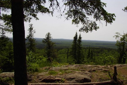
Eagle Mountain is a 7-mile out and back hike that takes you to the highest point in Minnesota. Ironically, there are no views from the summit as it’s hidden in the forest. But just before the summit, you are rewarded with a gorgeous overlook of the lakes of the Boundary Waters.
This is a very popular trail on weekends. The best time to do the trail is probably in the fall when color is at a maximum. The spring is when the trail is most soggy. Summer is sometimes buggy. The parking lot is often filled and sometimes you need to park on the road. The surface of the trail is similar to a heavily traveled BWCA portage; it is always easy to follow.
The trail is well maintained for the first 50 rods or so and then starts to resemble a typical well traveled BWCA portage. There are a few areas along the trail that are marshy, but these areas have board plank crossings erected. Several other places are very rocky and require a little care with footing. The only strenuous part of the Eagle Mountain Trail is the last 0.8 miles or so beyond Whale Lake. This part of the trail heads up to the summit. This last stretch will leave folks in average shape sucking some wind.
Almost everyone visiting the Eagle Mountain Trail is doing the trail on a BWCA day permit. You need to fill one out before beginning your hike. The Eagle Mountain Trail begins outside of the BWCA, but enters the designated wilderness area where it crosses Whale Creek. If you plan on camping overnight, you need to go through the regular BWCA permit process and get a permit for Entry Point #79.
There are two campsites along the trail, both in the Whale Lake area.
You will know you are at the top of Eagle Mountain when you reach the large rock with the sign embedded into it. There are two vista viewing areas near the top where the forest doesn’t block your view. The true summit is near the second wide vista where you can see several lakes off in the distance. From the first vista area, there are surprisingly no lakes to be seen. The trail that leads to the actual summit (often marked by cairns) leads back into the woods. It is about a three to five minute walk depending on pace. There are no views from the true summit of Eagle Mountain.
Cell Receptions
NoneADA Accessible
NoOpen Season
FallStroller Friendly
NoTerrain Type
DirtWater Fountain
NoBathrooms
NoPet Friendly
YesFee
$16.00Nearby convenience store
NoCamping Nearby
YesEmergency support within 5 miles
NoTrail Length/Type
7.00 mi., Out & Back
Helpful Trail Information
Camping Nearby, Creek / River, Lake, and Viewpoint
Parking Details
Only for overnight use; $16/adult permit fee, $8.50/child
Elevation gain
550 ft.